The Big Thicket National Preserve- “One’s fondness for the area is hard to explain. It has no commanding peak or awesome gorge, no topographical feature of distinction. Its appeal is more subtle.” – Big Thicket Legacy, University of Texas Press, 1977. The Big Thicket National Preserve is a heavily forested area that lies within Hardin, […]
Category: camping
Resolve to Tread Texas State Park Trails in 2014
Resolve to Tread Texas State Park Trails in 2014 AUSTIN – Vow to battle the post-holiday letdown and shed those unwanted pounds by pounding a Texas State Park trail, beginning Jan. 1, at more than 60 organized First Day Hikes that will kick off the New Year as part of a growing nationwide tradition. Remember, too, that […]
Sabine River
Sabine River The two upper forks of the Sabine River, the South and Cowleech Forks, are formed in eastern Collin County and northwestern Hunt County respectively. These two forks meet in Hunt County forming the main stream which flows southeast through pine woods for approximately 555 miles, partially forming the boundary between Texas and Louisiana. […]
Sea Rim State Park
Sea Rim State Park is composed of 4,141.1 acres of marshland, and 5.2 miles of shoreline along the Gulf of Mexico. The park is located in Jefferson County, just south of Port Arthur. The property was acquired in 1972, from Planet Oil & Mineral Corporation and Horizon Sales Corporation. The park opened to the public […]
Lake Livingston State Park
Lake Livingston State Park is located one mile southwest of Livingston. The park is composed of 635.5 acres along the shores of Lake Livingston, an 84,800 acre reservoir. The park property was acquired in 1971 and was opened to the public in 1977. The park is near the ghost town of Swartwout, a steamboat landing […]
Purtis Creek State Park
Purtis Creek State Park is composed of 1,582.4 acres in Henderson and Van Zandt counties. The property was acquired in 1977 from private owners and opened to the public in 1988. The area was once roamed by the Wichita and Caddo Indians. To the east of the park is a cliff over hang that was […]
Sheldon Lake State Park
Sheldon Lake State Park and Environmental Learning Center is a 2,800 acre outdoor education and recreation facility located in northeast Harris County. The park is split into two units and provides access to the 1,200 acre Sheldon Lake. Eight hundred acres of Sheldon Lake are permanently inundated, while 400 acres are marsh and swamp land. […]
Lake Tawakoni State Park
Lake Tawakoni State Park is composed of 376.3 acres in Hunt County. The property was acquired in 1984 and authorized through a 50 year lease agreement with the Sabine River Authority, which operates the 36,700 surface-acre reservoir and Iron Bridge Dam, on the headwaters of the Sabine River. The area was originally home to the […]
San Jacinto River
San Jacinto River, West Fork The San Jacinto River has its beginnings in its East and West Forks in San Jacinto and Walker Counties, respectively. The two forks then flow into northeastern Harris County where they merge to form the main stream. The main stream is dammed just below the confluence of its two forks, […]
Mission Tejas State Park
Mission Tejas State Park By Dana Goolsby Houston County- East Texas is full of amazing history and natural beauty. Mission Tejas State Park fully encompasses both the rich history of East Texas and the natural wonder and beauty of the Pineywoods and affords visitors the chance to experience both to the fullest extent. Mission Tejas State Park is […]
Galveston Island State Park
Galveston Island State Park is a paradise located on the west end of Galveston Island. The park is within the Galveston city limits and in Galveston County. The park is composed of 2,013.1 beautiful acres overlooking both beach and bayside terrain. According to the Texas Parks and Wildlife Department (TPWD), the site was acquired in […]
Dangerfield
Dangerfield State Park, in Morris County southwest of Texarkana, is a 506.913-acre recreational area, including an 80-surface-acre lake. The area was the center of the iron industry in Texas, and original improvements were made by the Civilian Conservation Corps (CCC). Springtime in the park brings amazing sights throughout the park’s rolling hills as the dogwoods, […]
Martin Dies, Jr. State Park
Martin Dies, Jr. State Park was known as Dam B State Park until 1965. The park is a 705 acre area in Jasper and Tyler counties, located between Woodville and Jasper on the 15,000 acre B.A. Steinhagen Reservoir. The property was acquired under a 50-year lease from the U.S. Army Corps of Engineers in 1964 […]
Lake Quitman
Lake Quitman is located five miles north of Quitman, in Wood County. The lake is 814 surface acres, with an average maximum depth of 25 feet. Aquatic vegetation in the lake is limited. Flooded timber, boat houses and brush piles provide limited cover. Aquatic vegetation is sparse. Alligatorweed and water hyacinth are present and are […]
Sam Houston National Forest
Sam Houston National Forest is located 50 miles north of Houston, within Montgomery, San Jacinto, and Walker counties. The Sam Houston National Forest has 161,508 acres with 47,609 acres in Montgomery County, 59,746 acres in San Jacinto County, and 54,153 acres in Walker County. The forest is administered with the other three national forests located […]
August 2014 Events at Mission Tejas State Park
August 2014 Events at Mission Tejas State Park Weches, Texas– There is still time to get in an outdoor adventure or two before summer ends! Mission Tejas State park will host a different event each weekend and the park offers some of the best hiking views and trails in East Texas. August 2: Guided Tour of […]
Lake Jacksonville
Lake Jacksonville is located three miles southwest of Jacksonville in Cherokee County, off US 79. The lake is 1,320 surface acres, with an average maximum depth of 62 feet. Aquatic vegetation in the lake is sparse. Although hydrilla was a problem in the past, the City of Jacksonville has enacted an integrated management plan using […]
Lake Livingston
Lake Livingston is located west of Livingston and 50 miles north of Houston in Polk, San Jacinto, Trinity and Walker counties. The dam is located in Polk and San Jacinto counties. The lake is 90,000 surface acres, with an average maximum depth of 77 feet. Native emergent plants are limited to the upper areas of […]
Caddo Lake State Park
Caddo Lake State Park Caddo Lake State Park is located on the only natural lake in the Lone Star State. The lake was eventually dammed in the early 1900s when oil was struck and for flood control. Caddo Indian legends tell of a giant flood that gave way to the formation of the lake. Some […]
Fairfield Lake
Fairfield Lake Fairfield, TX. Fairfield contains an easy day hike through woods and fields above Fairfield Lake.As you approach the entrance station, the Dockery Trail is on the right and parking for the Big Brown Creek Primitive Camping Area is on the left. This trail allows hiking and mountain bikes and ends at primitive tent […]
Huntsville State Park
Huntsville State Park is a 2,083.2 acre recreational area, located six miles southwest of Huntsville, in Walker County. During the early 1930s, the Huntsville-Walker County Chamber of Commerce proposed the creation of a large public recreation place to the Texas State Parks Board. The board in turn informed the land would have to be donated […]
nac
Share on Facebook Tweet on twitter Share on google+ Pin to pinterest
Attoyac Bayou
Attoyac Bayou- Attoyac Bayou, formed in southeast Rusk County near the town of Mount Enterprise, flows approximately 58 miles southeast into the Angelina River and Sam Rayburn Reservoir. Forming the boundary between Nacogdoches, Shelby, and San Augustine Counties for much of its course, Attoyac Bayou flows through forested hardwood bottomlands, the majority of which are […]
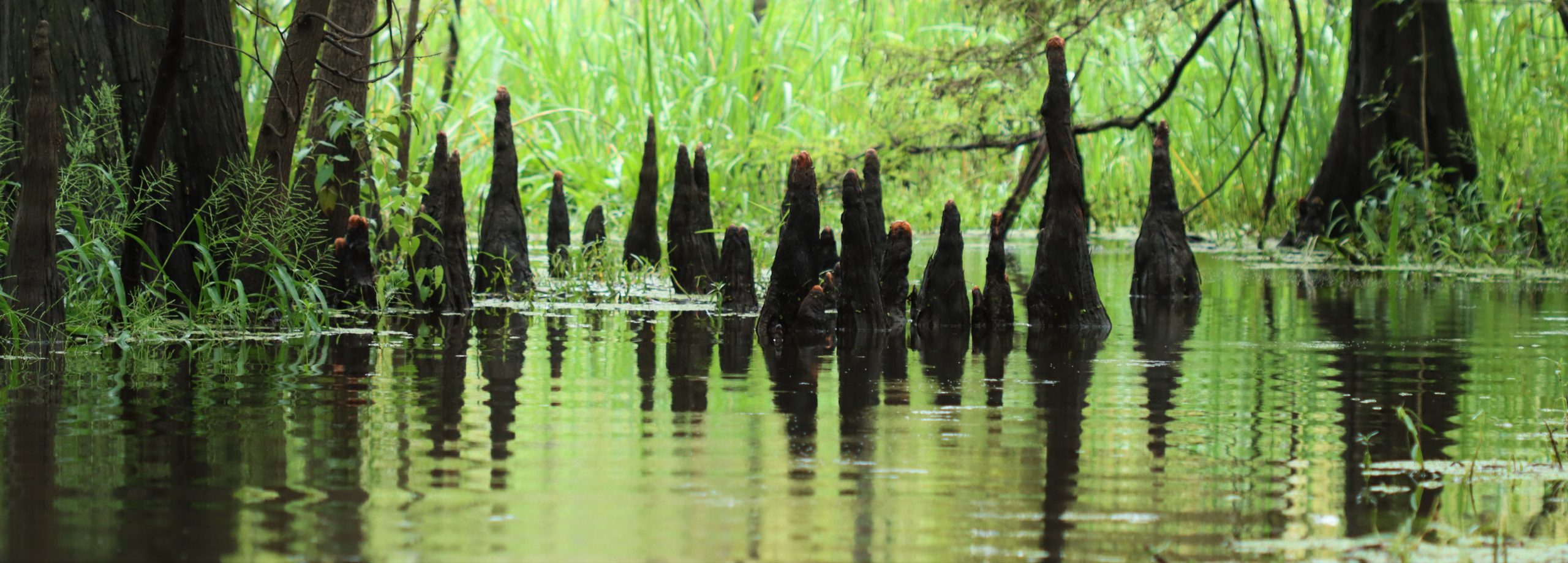
Neches River
Neches River Formed in Van Zandt County of East Texas, the Neches River flows southeast for approximately 416 miles and empties into the Gulf of Mexico near Port Neches. A drainage area of 10,011 square miles and abundant rainfall over the entire Neches Basin results in a flow near the Gulf of approximately 6,000,000 acre-feet […]